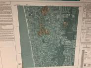
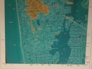
BRIEF SYNOPSIS OF MAP CHANGES
• Over time, flood risks and predicted levels of flooding change due to weather events, environmental changes, erosion, land use and other factors. Maps are updated periodically to reflect these changes.
• Risk MAP is a FEMA flood-map update, Risk Mapping, Assessment & Planning (Risk MAP) will analyze coastal wave action to create new elevation data for Flood Insurance Rate Maps (FIRMs) (flood maps).
• This is an updated advanced coastal analysis by FEMA (Federal Emergency Management Agency) contractors/consultants.
• In 2013, FEMA initiated a coastal flood risk study for the Southwest Florida Study Area that affects Charlotte, Collier, Desoto, Hendry, Lee, and Sarasota Counties.
• February 2014, FEMA notified the City of Naples that it is analyzing coastal wave action in the Gulf of Mexico as part of its Risk MAP program.
• The FEMA analysis was used to create new elevation data for Flood Insurance Rate Maps (FIRMs). The maps are based on existing conditions (not future conditions).
• Preliminary maps were released by FEMA in the December of 2019.
The new preliminary flood maps, which are officially called Flood Insurance Rate Maps (FIRMs), will reflect current flood hazards resulting from a series of in-depth, large-scale studies that examined the flood hazards and risks in the affected coastal counties and some inland riverine areas.
We're here to help city residents navigate FEMA's map changes. To find out whether your flood zone or Base Flood Elevation (predicted level of flooding) has changed as a result of these preliminary map changes, click here.
Risk Mapping, Assessment & Planning (Risk MAP) analyzes coastal wave action to create new elevation data for Flood Insurance Rate Maps. This may affect rates on National Flood Insurance Program (NFIP) policies and construction regulations for some parcels and structures in the City of Naples.


